Office of the Coordinating Member
E-Mail:
Office: Studihaus, ST 102
Phone: 0651 603 492 20
Fax: 0651 603 492 31
Address
Koordinierendes Mitglied des AStA der Universität Trier
Leonhard Székessy
Universitätsring 12b
54296 Trier
How to get there
Zur Universität
Mit dem Fahrrad zur Universität
Zum Studihaus für Lieferdienste und Rettungskräfte
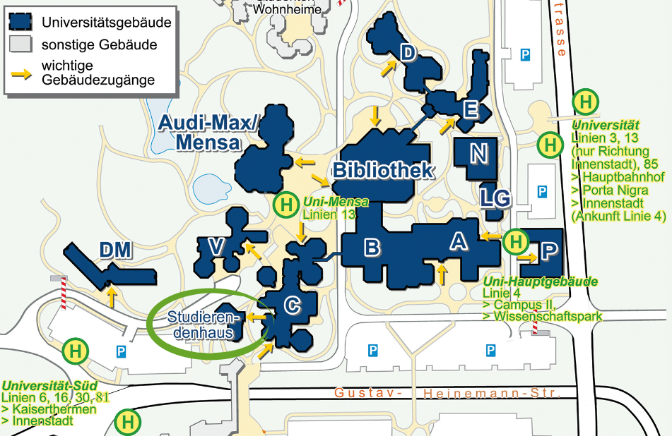
campus map

DIRECTIONS TO THE STUDIHAUS FOR DELIVERY SERVICES AND RESCUE TEAMS

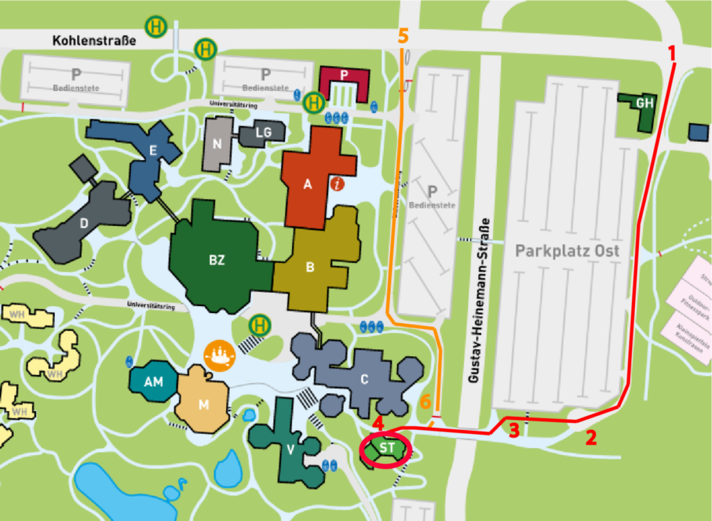
Access to the Studihaus is via Kohlenstraße.
Outside of the opening hours of the university:
Adress for Google Maps / Apple Maps: Im Treff 21, 54296 Trier (leads to marker [3])
To reach the Studihaus, drive from Kohlenstraße in the direction of the Parkplatz Ost into the extension of ‘Gustav-Heinemann-Straße’ [1]. Now drive straight ahead past the car park to reach the small turning circle [2]. From there, continue straight ahead onto the street ‘Im Treff’. Then cross the road past the catering establishments until you reach the university campus (‘Universitätsring’). The Studihaus is located on the left-hand side [4].
Within the opening hours of the university:
Address for Google Maps / Apple Maps: Universitätsring 12b, 54296 Trier (leads to marker [6])
If the barrier is open, you can use the driveway to the main entrance/staff car park from Kohlenstraße [5]. Then follow the road past the car park to the next barrier [6]. If this is open, you can turn right to the Studihaus [4]. If the barrier is closed, the Studihaus is also reachable within walking distance.